


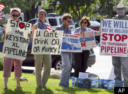
Keystone XL Pipeline Obama's 'Biggest Climate Test,' Green Groups Say
Wednesday, August 24, 2011
How far down does the oil have to go to get to the water? That depends. The SandHills consist of three major ecosystems. By far, the most common are “dunal uplands”. These are the large, sculpted dunal ridges that can rise up to 300 feet above the inter-duna l valley floors. If the pipeline is buried 12 or so feed below the surface, there could be 100 or more feet to the actual water table. The other common ecosystems are “dry valley floors” where the water table is between 3 and 30 feet below the surface, and “subirriga ted meadows” where the water table intersects the land surface at least for part of the year. In either of these ecosystems , the leak would be directly (or almost directly) into the aquifer.
Is there a real threat of a leak? I certainly think so. TransCanada grossly underestim ated the potential for leaks on their existing pipeline. They estimated that there would be one leak every 7 years. Since the line has opened (2 or 3 years ago) there have been 12 or so.
So what would the solution be? The country wants oil. The world needs the clean water of the aquifer. The pipeline will leak. Simply move the route to a less ecologically sensitive area! I’ll bet that the cost to move the route will be much less than TransCanad a will spend cleaning up the mess they are sure to make!
Think BP and Deepwater Horizon
About Gas
Read the Article at HuffingtonPost
0 comments:
Post a Comment